Rolland Moore Is the Best Park in Fort Collins
The first Tortoise and Hare race of the season kicked off at Rolland Moore Park this month. It’s always a fun event
and this one was special as it wasn’t even cold at the early morning start. The runners got a good set of changing colors on the trees as we trotted along the Spring Creek Trail.
Throughout the race I kept thinking how Rolland Moore really is my favorite park in town.
I usually do my best not to speak in superlatives. I mean, my favorite is going to be different from your favorite for very specific and understandable reasons. Still, running with the idea in my head, I tried to think of why it is the best. I couldn’t help but start drawing things on the map in my mind. Maps in the mind don’t do too much good, so I went ahead and used this opportunity to explore a new R-spatial tool integration to try to visualize my logic behind why Rolland Moore is the best park in Fort Collins.
The trail runs through it
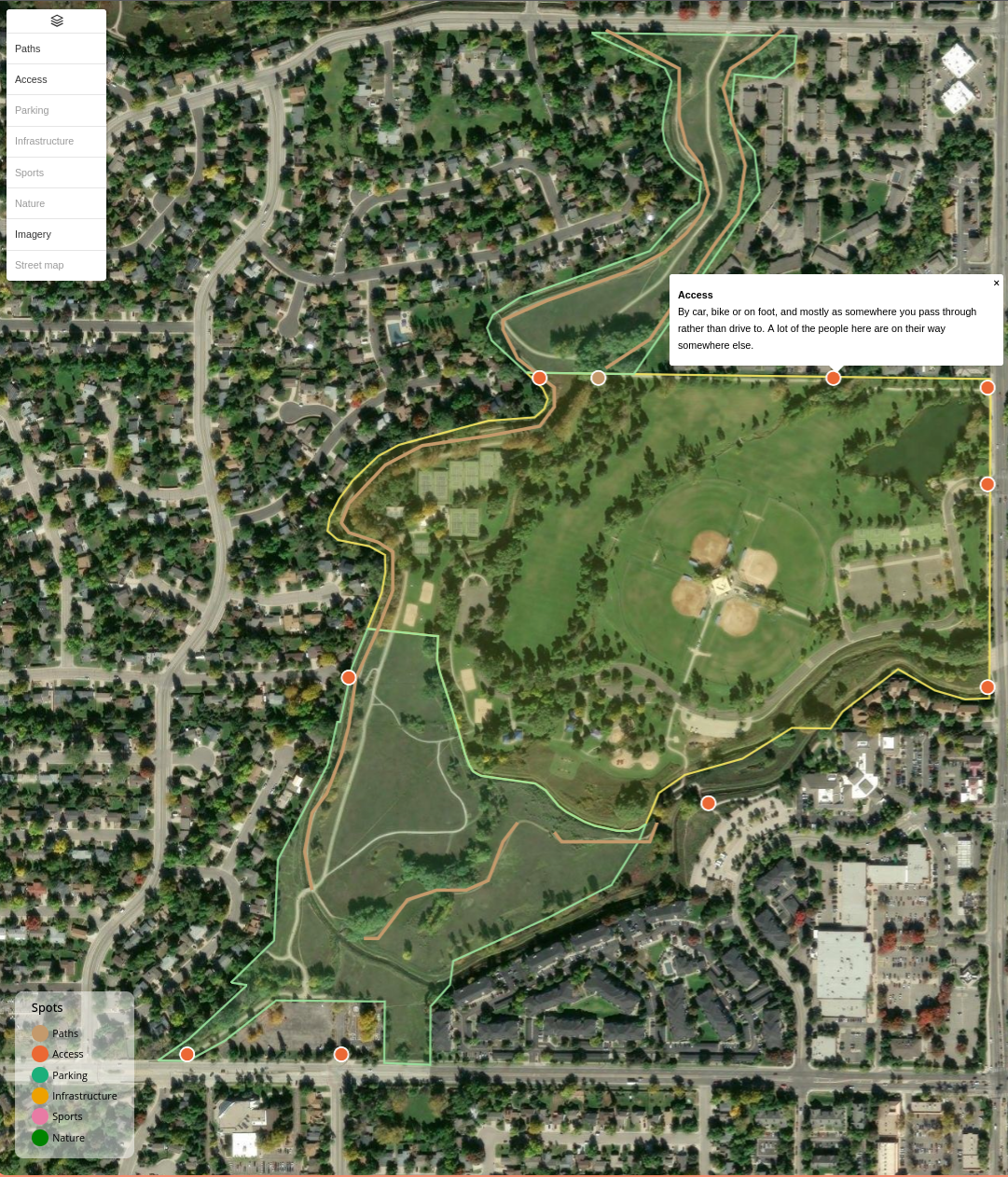
To me this park is about the trail network more than anything. The Spring Creek Trail runs right through the middle, with Ross Natural Area along the south and west and Fischer Natural Area to the north. Over my years in Fort Collins, I’ve lived in places that have sent me west along the Spring Creek Trail or southeast into the Fox Meadows area for my commute home. And I think a lot of people are in this boat.
The fact that the park is on such a major transportation route means that there are a lot of people who end up in Rolland Moore who didn’t drive there. They are on their way somewhere else, by bike or on foot, and the park happens to them. Compare this to the Mason Trail, which is great, but it’s definitely a highway of the bike paths. No chance opportunities to relax and appreciate things, or at least not in the same way.
I think it’s also really important to note that you can get to the park from Shields or Drake, as well as multiple neighborhoods. There are just tons of access points and I think that increases its utility to the community. It’s not an end of the road park, it’s a pass-through park.
The paved trail is only half the story. There are dirt paths along the canals and they are reasonably shaded, which is awesome if you’re running in the summertime.
Within the neighboring natural areas there are a couple of trails that look to be generated just from people exploring rather than a planner. These are social trails, and I really like seeing them. I think it makes a big difference and adds a lot of character to the place. These paths exist because someone thought something interesting was in this direction and other people followed suit.
Parking, bathrooms, shelters
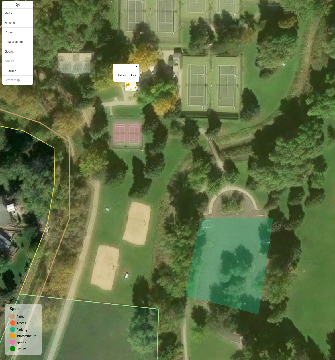
Most of the major parks throughout Fort Collins have parking, bathrooms and shelters, so this doesn’t necessarily make it unique, but it is a pretty valuable resource that I’ve definitely utilized in many different ways. Another reason the Tortoise and Hare event is here is that there’s parking enough for a whole race field. Having several small lots along the road gives each area its own access, with an easy backup to use if needed. The shelters you can book sit right next to the ones you can just walk up and use, and it all fits without giant parking lots taking over the place.
I am pretty sure the restroom by the tennis courts is one of the few public restrooms in the city that stays open through the winter, and if you run in January you know what that is worth. More often than not, my runs through the cold part of the year pass through Rolland Moore for exactly that reason.
The courts are there if that’s your sport: tennis, pickleball, volleyball, racquetball, and a small bike skills area on one corner that I’ve never used but can see taking my kids there to teach them some of the bike specific traffic signs.
Where the park stops being a park
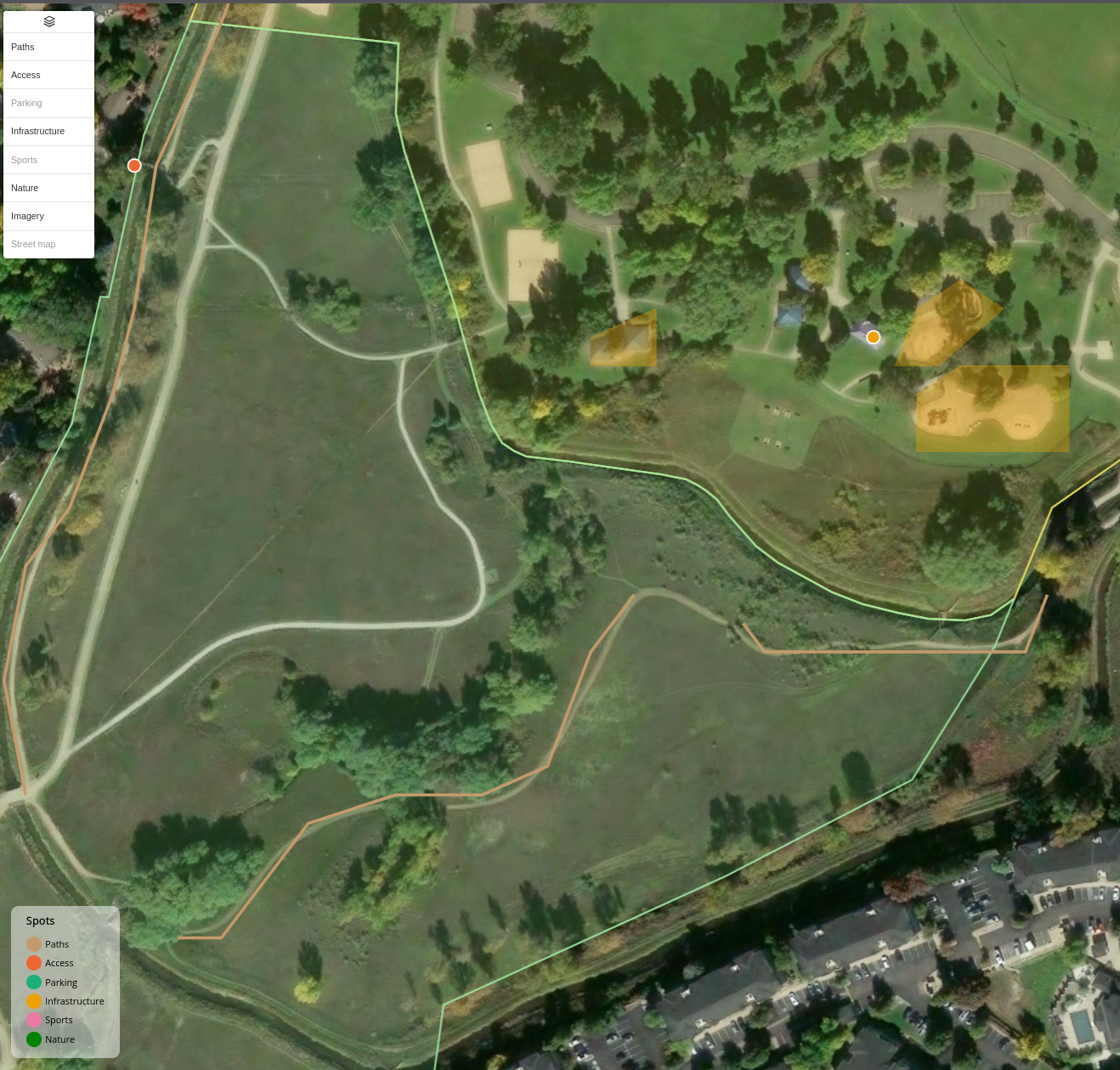
Much like the access points, Rolland Moore also has a lot of really unique interfaces with other elements of the city. The two natural areas are quite obvious and really just feel like an extension of the park. The line between mown grass and Ross or Fischer is a path, not a fence. The duck pond gets baby geese every spring. There is a cottonwood that might be the largest in Fort Collins. The canals along the edges bring water and the small stream running through the middle of the park gives kids a waterway they can actually get down to and play in.
The playground has a very distinct bigger-kid area and smaller-kid area. They’re right next to each other, but due to some hills and a little bridge between them, they do feel pretty unique and independent. This is older playground equipment too, so it feels different than the ultra-safety-first material you see at the newer parks.
There are a couple different types of neighborhoods surrounding the park as well, along with the Senior Center. You kind of feel like you’re in the park environment once you hit the Senior Center, and it’s open to a lot more than seniors. Just on the other side of it there are quite a few stores and places to pick up some food and walk back into the park if needed.
Honestly, the park scene in Fort Collins is generally the first thing I talk about when I describe why I like this town so much to others. It might just be a stage of having children who want to play on playgrounds at the moment, but I think these communal spaces are important and worth celebrating, and Rolland Moore is the best example of this in my mind.
Edora, and everywhere else
I am staking my claim that Rolland Moore is the best. If you came at me with Edora, I wouldn’t try to argue against you. Edora’s got the disc golf and a really nice skate park, and it sits further east on the same Spring Creek Trail and hits that connectivity and access point features that are so cool about Rolland Moore. Realistically the best park depends on what you’re into. The honest version of my argument is that Rolland Moore does it well and it’s the park I actually travel through, so it’s the park I use and therefore have the most memories with.
How the map was made
Shortly after having this thought about Rolland Moore, I was inspired by some posts about mapgl and Terra Draw in R that I saw on LinkedIn.
R is definitely my go-to source for working with geospatial data. However, it’s always had a bit of a roadblock when you need to create specific geometries. The mapgl package changed that: it wraps MapLibre GL for R and, as of recent versions, carries Terra Draw, so this map came together in a small Shiny app where I could select and draw the specific features I wanted to create. Pick a Class, click out a point, a line or a polygon over satellite imagery, and it lands as an object you can see, save, and attribute some text to.
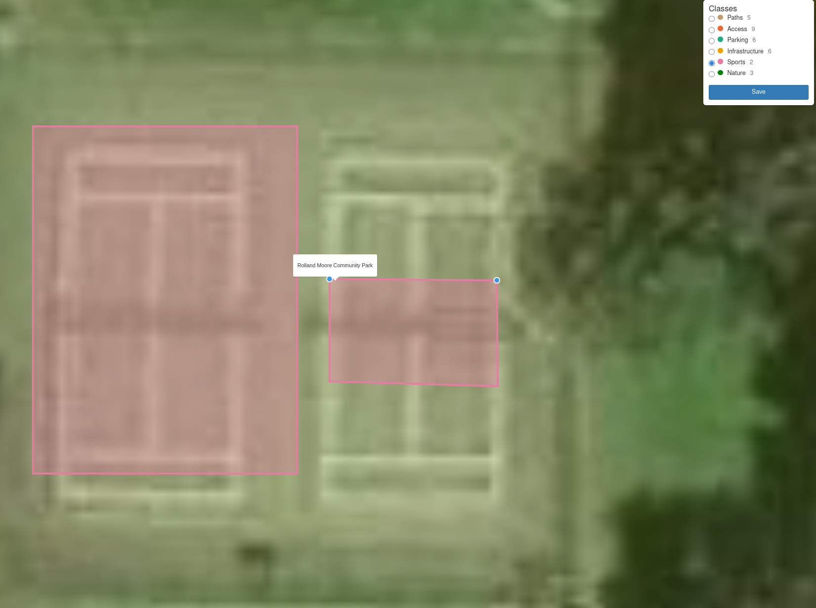
The precision is better than I expected. The pickleball courts are on the map because I wanted to see how fine the drawing could go, and the answer is: the kitchen of a single court, traced from the imagery. Zoom in on the Sports Class and you will find it.
The whole drawing setup is one function:
draw_map <- function(boundaries, spots) {
  base_map(boundaries) |>
    add_layers_control(position = "bottom-left",
                       layers = c("Imagery", "Street map")) |>
    add_source(id = "spots", data = spots) |>
    add_terradraw_control(
      source = "spots",
      modes = c("point", "linestring", "polygon", "select"),
      options = terradraw_options(keep_mode_active = TRUE),
      fill_opacity = 0.35, line_width = 4, vertex_radius = 7,
      active_color = "#ff3b6b"
    )
}
Saving writes everything to a single GeoPackage, which is also what the published map is built from, so the data you are clicking on is an ordinary GIS file you could open in a desktop GIS. The park and natural area boundaries come from the City of Fort Collins open data and are approximate. The code, the data and the Draw tool are all in the repository: TODO-GITHUB-URL.
-->